Introduction & Database
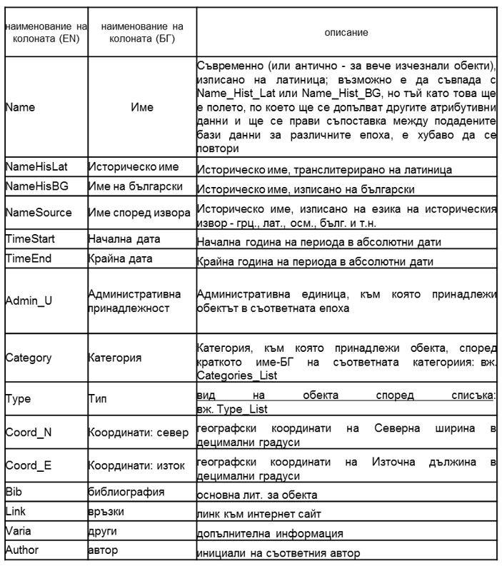
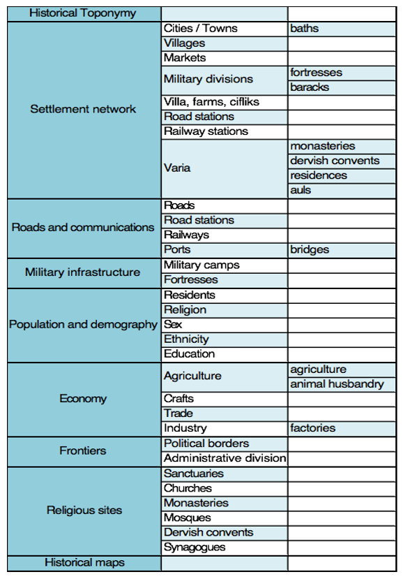
Although the term “Thrace” has variable meaning within this frame every single period represented in the project defines its geographic borders, corresponding to the specific geographic, political or cultural sense. A Database has been developed for analysis and visualization of historical-geographic data such as: historical toponymy; roads and communication, military infrastructure; settlement network and historical demography; economy; religious sites, etc. The specialized historical data is created as a number of tables, including object coordinates. The tables are imported in ArcGIS (ArcMap) and converted to ESRI shapefile format (*.shp).
Based on ArcGIS на ESRI inc. the GIS – Platform includes:
- Desktop client for data research analysis,
- Data bases – databases and database management systems. Its function is to store all data in a standard relational model,
- Web – online application.
Supported standards:
- Web Features Service (WFS),
- Web Coverage Service (WCS) and
- Web Map Service (WMS).
After processing, this data is stored in the following structure:
- Excel tables – Name,
- NameHisLat,
- NameHisBG,
- NameSource,
- TimeStart,
- TimeEnd,
- Admin_U,
- Category,
- Type,
- Coord_N,
- Coord_E,
- Bibliography,
- Author.